San Carlos, Brasil
2000
Rosario, Argentina
2001
La Plata, Argentina
2003
Presentations in Young Researchers Meetings organized by Universities Association Montevideo Group (AUGM). |
|---|
|
|
|
|---|---|---|
| VIII Meeting San Carlos, Brasil 2000 |
IX Meeting Rosario, Argentina 2001 |
XI Meeting La Plata, Argentina 2003 |
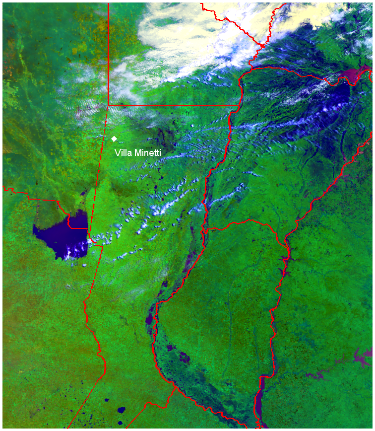
Flood monitoring.
| Monitoring the flooding at Villa Minetti, province of Santa Fe, Argentina. NOAA-17 satellite images, 124-RGB bands. | |
 |
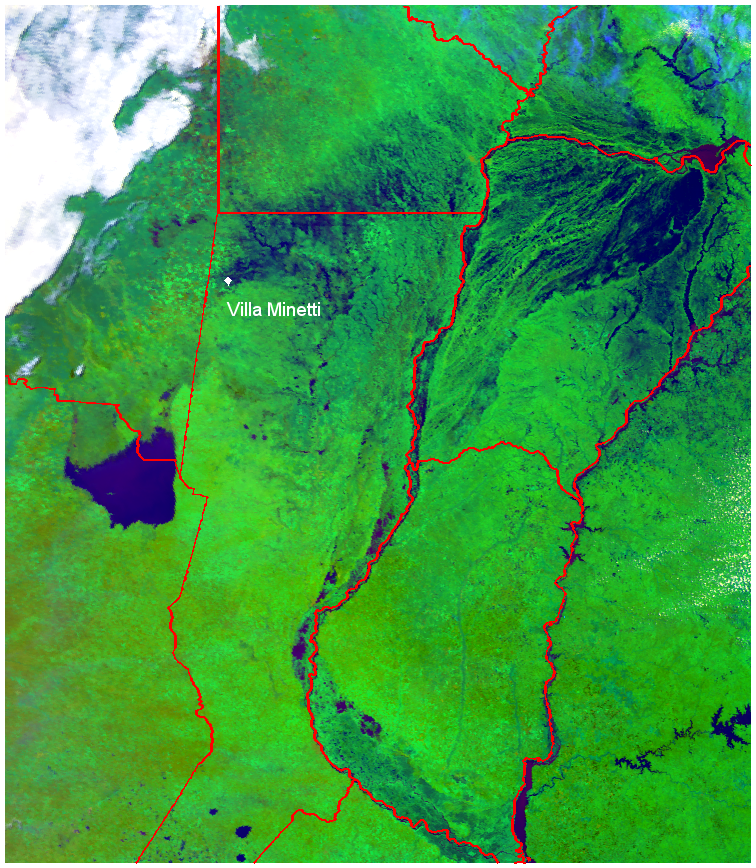 |
| 18/12/2003 |
23/12/2003 |
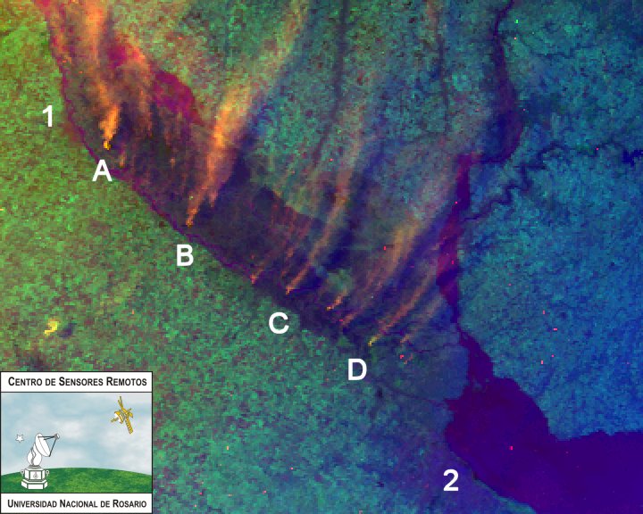
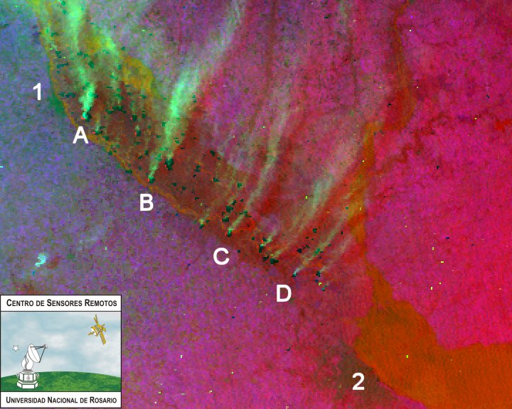
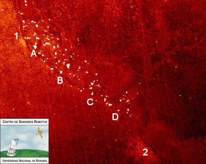
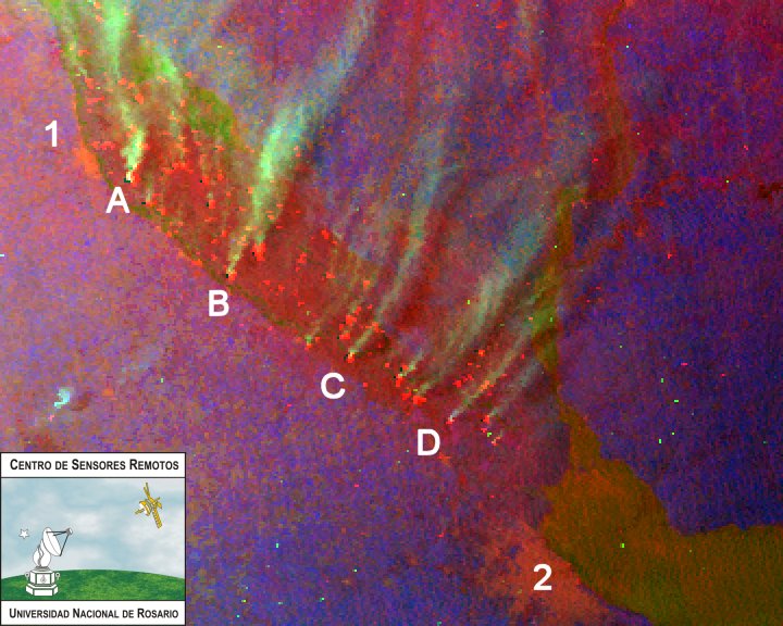
Fires monitoring.
| NOAA-12 satellite images, date 25/08/2004, time 20:43:46 (GMT -3). | |
 |
 |
| 124-RGB bands |
312-RGB bands |
 |
 |
| 3T band |
3T12-RGB bands |
Ref.: 1-Rosario, 2-Ciudad Autónoma de Buenos Aires, A-Villa Gob. Galvez, B-Ramallo, C-Baradero, D-Zárate |
|
|
|
 |
 |
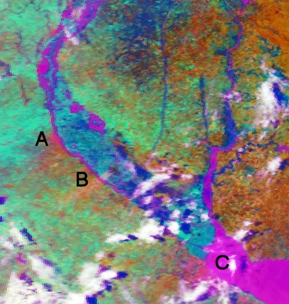
124-RGB bands |
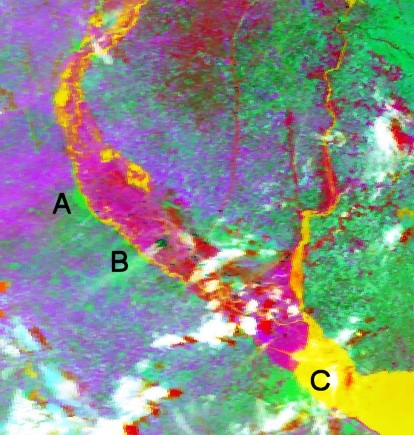
312-RGB bands |
 |
 |
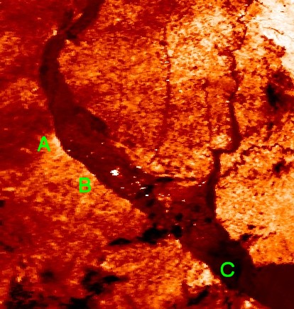
3T band |
3T12-RGB bands |
| Ref.: A-Rosario, B-San Nicolás, C-Ciudad autónoma de Buenos Aires | |
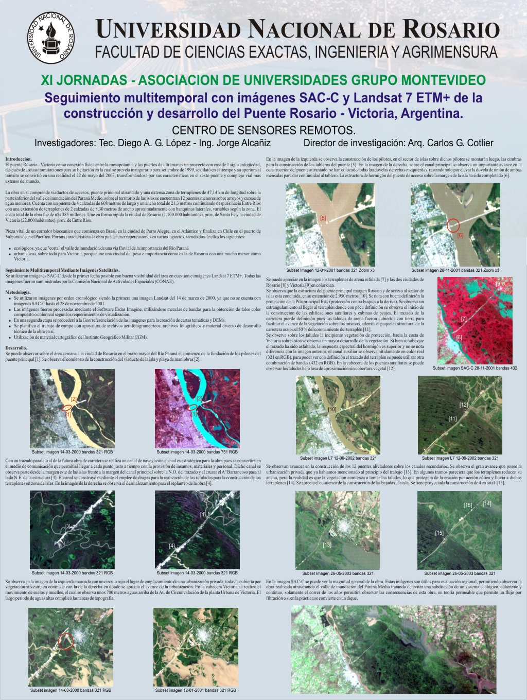
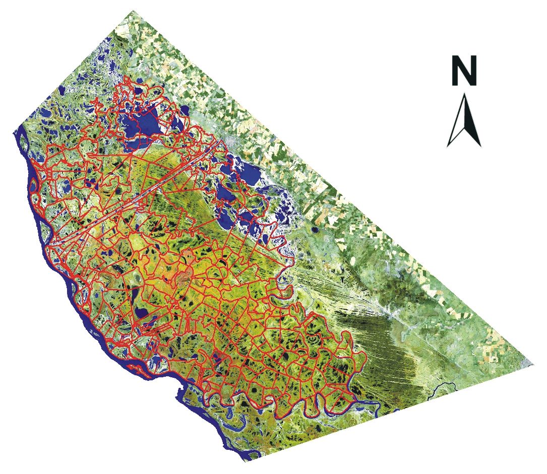
Geographic Information Systems implementation of the parceled lands of the Isles Region of the Victoria Municipality, province of Entre Ríos, Argentina. |
|
 |
|
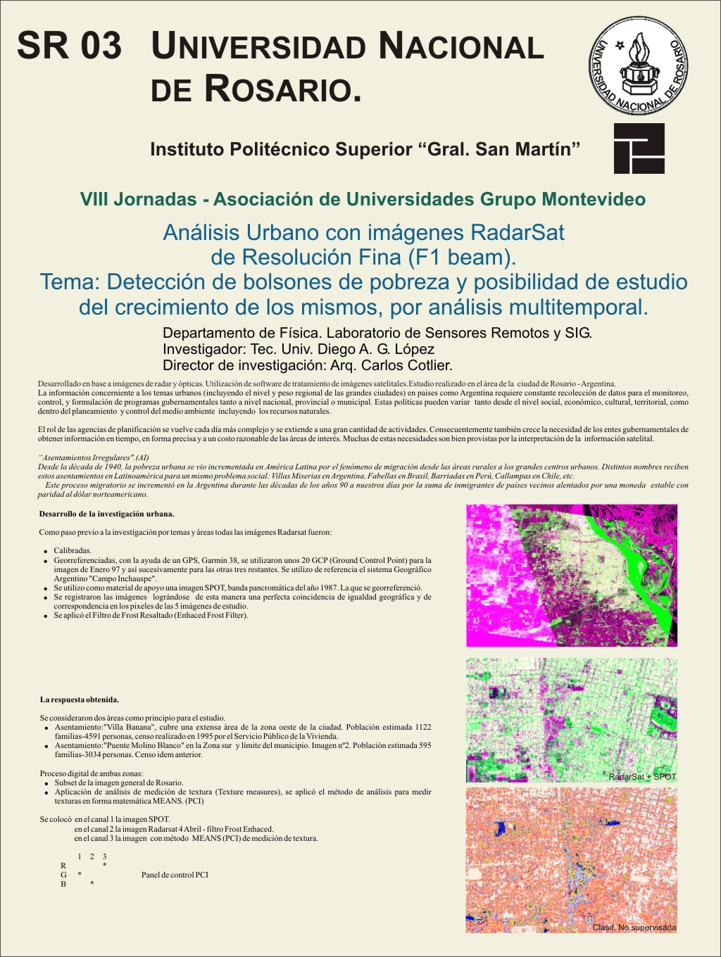
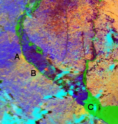
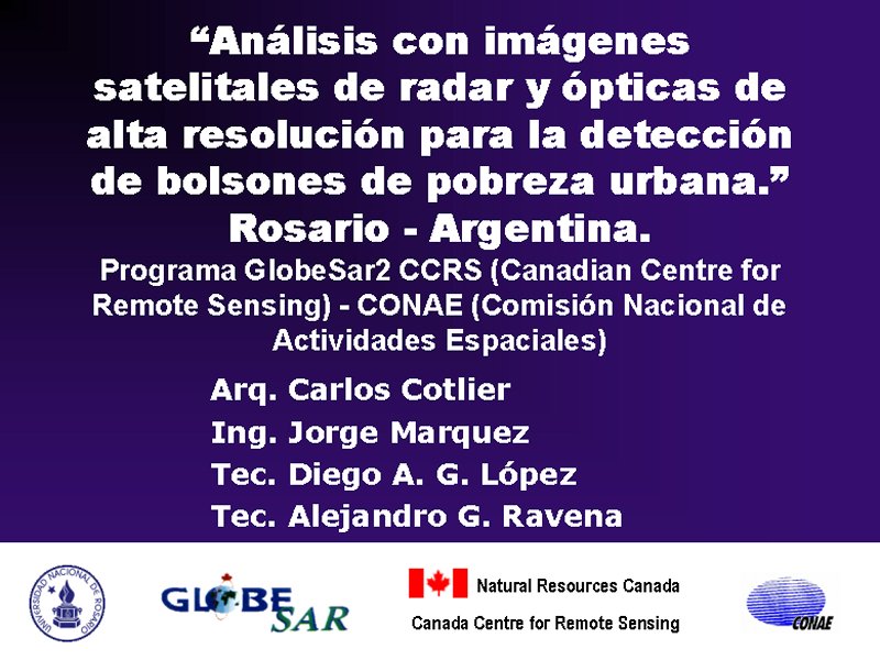
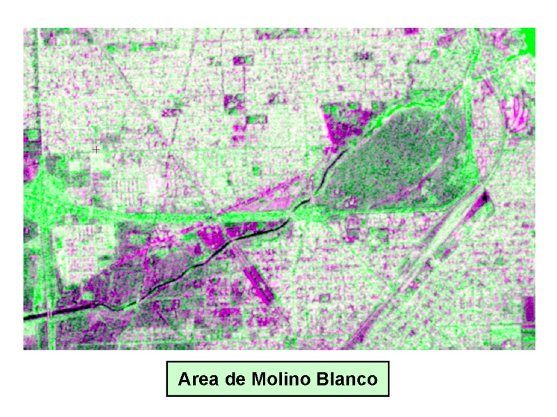
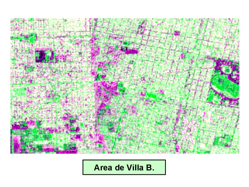
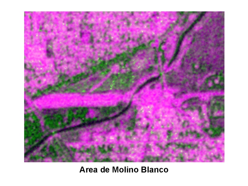
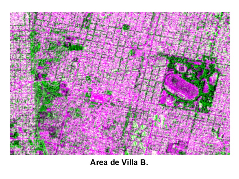
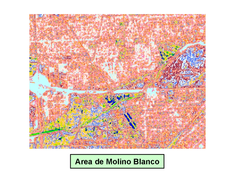
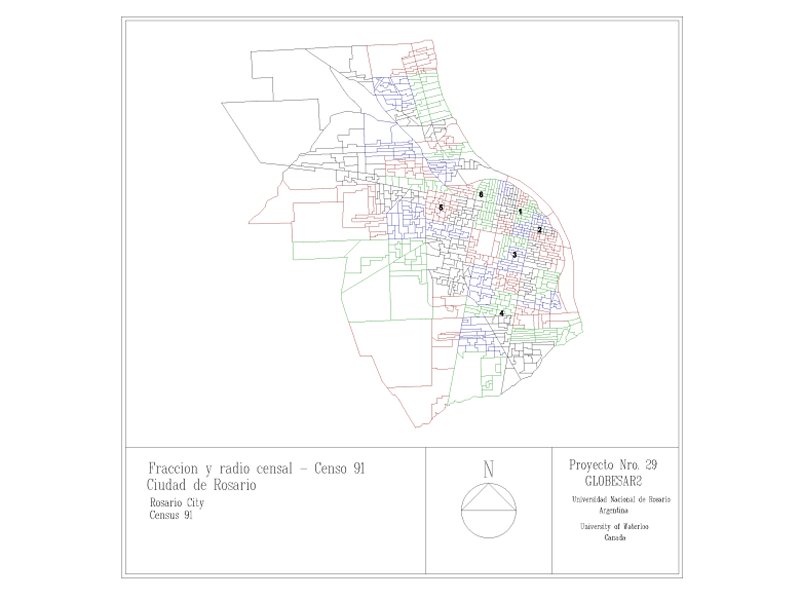
Detection of Urban Poverty Pockets. GlobeSar2 Program CCRS (Canadian Centre for Remote Sensing) - CONAE (Comisión Nacional de Actividades Espaciales).
|
||
 |
 |
 |
 |
 |
 |
 |
||
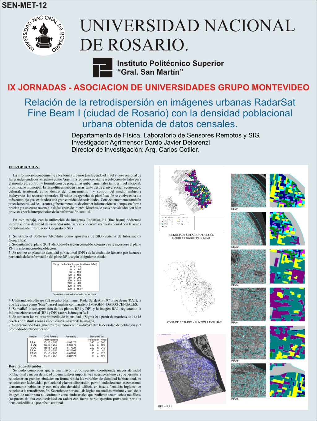
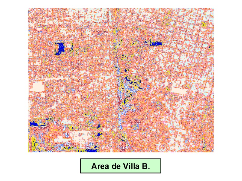
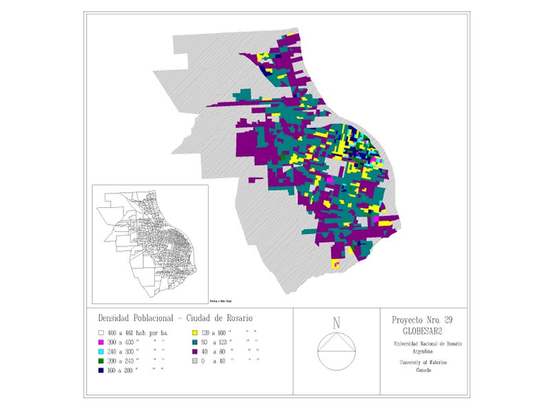
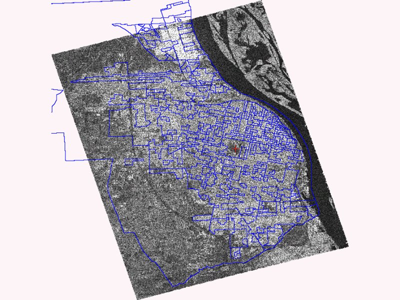
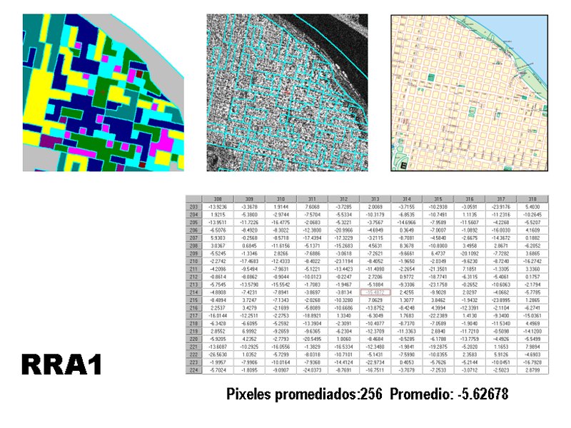
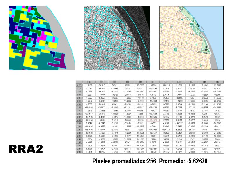
Relation of the back scattering in RadarSat Fine Beam I urban images with urban population density obtained from census data. Rosario, Argentina. GlobeSar2 Program CCRS (Canadian Centre for Remote Sensing) - CONAE (Comisión Nacional de Actividades Espaciales).
|
||
 |
 |
 |
 |
 |
 |
 |
||
Accredited Research Projects by Science and Technology Office of the National University of Rosario. * ING182. Use and expansion of urban soil (Land Use) and y cover (Land Cover) in Rosario and Grand Rosario area, with data of Radar and Optics satellite images, maps, topographic charts and aerophotogrametry - 1906-2006. * ING187. Detection and growth of Urban Poberty Pockets with Ultra Fine Beam Radar and High Resolution Optics images on Rosario and Gran Rosario area, Santa Fe, Argentina. Research Project under SOAR Program. * 3294. Urban Poberty Pockets detection with Ultra Fine Beam Radarsat images. |
|---|